Category
Drones
Description
Identification and counting of the number of plants per sampling unit.
The algorithm individually detects the plants present in the delimited area in the image, accurately calculating the total number of emerged plants.
Results
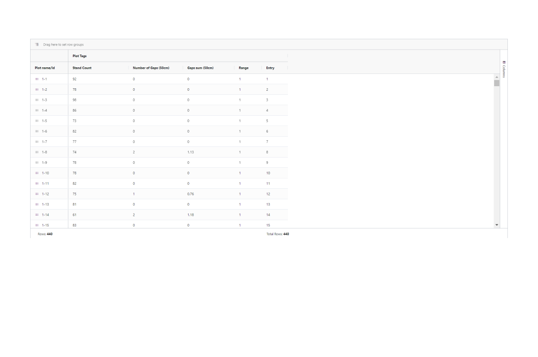
– Stand count results available in Vault Data Editor
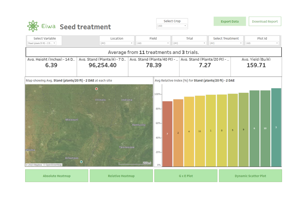
– Stand Count Heatmap
Supported Crops
– Corn
Data Delivery
- Vault Data Editor
- Vault Field Viewer – Trial Heatmap
- Results API
- BI Dashboards
Requirements
General Requirements
– Perform a drone flight over the area where stand count assessment is desired
– Upload imagery into Eiwa Vault.
– Geolocate the area of interest to be processed
Flight Recommendations
Imagery Type
– RGB
Ground Sample Distance
– 0.55 cm/px
Flight Moment – Phenological Stage
Corn: V2-V4 growth stage
Flight Specifications
Sensor
- Phantom 4 Pro
- Mavic 2 Pro
- Mavic 3 Enterprise
Overlap 80%
Altitude 20m / 65ft
Glimbal Pitch 90%
Heading/Face Forward
Speed 10mph/ 4.5m/s