Category
Drones
Description
Like other vegetation indices, it seeks to monitor variations in the color of the crop’s vegetation cover, without the need to use sensors outside the visible light spectrum.
Differences in the NGRDI can direct the identification of causal factors, as well as help the quantification of variations identified in the field.
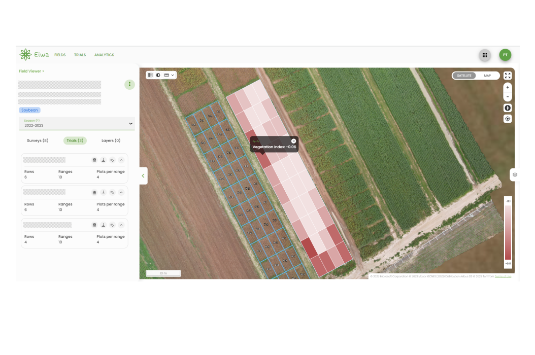
Results
- Average NGRDI value for the area of interest
- Coefficient of variation for the area of interest
Data Delivery
- Vault Data Editor
- Vault Field Viewer – Trial Heatmap
- Results API
- BI Dashboards
Flight Recommendations
Flight Moment – Phenological Stage
No specific crops or phenological stages are required for this analytic service.
Data Capture Requirements
Imagery Type
– RGB
Ground Sample Distance
– 1.1 – 2.2 cm/pixel (will depend on crop growth stage)